The tour of Lake Annecy is a trek that can be done between 6 and 7 days. You will evolve between forests, mountain pastures, limestone peaks with reference to Lake Annecy, this jewel with turquoise waters in the center.
In this article, we describe the tour with a departure from Annecy (old town) in the classical sense (anticlockwise). The trek can of course be done in the other direction.
In order to estimate the travel time, we have based ourselves on a walking speed of about 3km on the flat and a speed of ascent (and descent) of about 300m/hour.
Stage 1: Annecy - Refuge du Semnoz
D+ 1370 m
D- 275 m
Distance 18 km
Walking time 6h
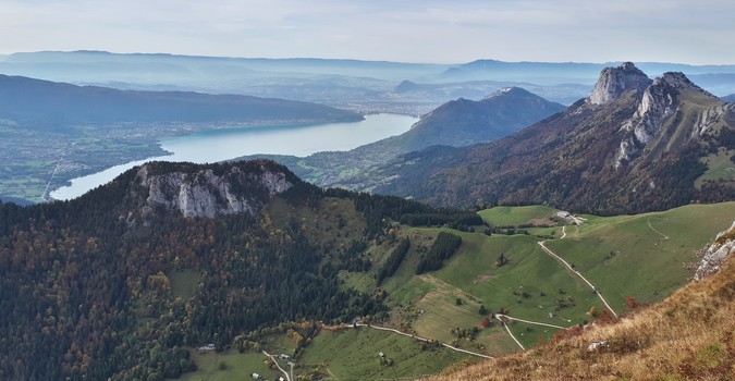
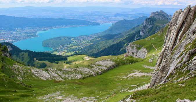
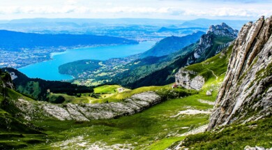
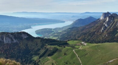
The first day is from the old town of Annecy. You will set off to conquer the Semnoz, the mountain of the Ancients, which is located in the Bauges regional nature park. Most of the route will take place in a forest environment. You can follow the GRP route to the top of Semnoz or use the Way of the Crosses (a variant) which will allow you to enjoy some beautiful views of the lake and the Tournette. It is only from 1600m onwards that the forest gives way to the Semnoz mountain pasture and a panoramic view of the Northern Alps and Mont Blanc. When you arrive at the refuge, don't confuse the Lac du Bourget and the Lake Annecy!
Stage 2: Refuge du Semnoz - Gîte Mont devant
D+ 715 m
D- 1240 m
Distance 17 km
Walking time 6h30
This day will essentially take place on the marked route of the GR de pays. You will leave the Semnoz mountain pastures in the direction of the Leschaux pass. Part of the route will be on the road. Once you have passed the Sollier chalets below the Roc des bœufs, you will only have to descend to the Mont devant.
Stage 3 : Gîte Mont devant - Refuge de la Combe
D+ 950 m
D- 420 m
Distance 9 km
Walking time 4h30
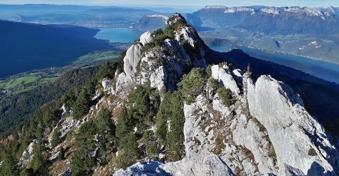
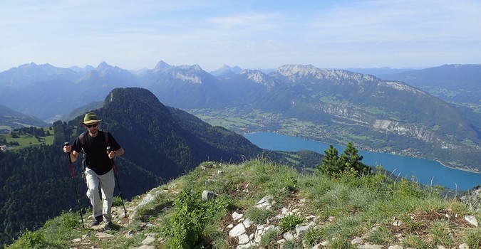
This stage is the shortest of the course, it will allow you to breathe and recover. You will start your day with a climb up to the Col de Bornette, border between Savoie and Haute-Savoie. Then along the Charbon mountain, you will take a steep passage, carved in the rock to reach the Charbon mountain pasture. You will be able to drop off your belongings at the refuge and go to the mountain of banc-plat to enjoy a spectacular view of the lake.
Stage 4: Refuge de la Combe - Refuge de Pré Verel
D+ 960 m
D- 1290 m
Distance 18 km
Walking time 7h30
Today, you leave the Bauges massif and head for the Tournette massif just opposite. After a long morning descent towards the village of Saury, cross the valley at the level of Doussard in order to recover the GR de pays at the level of the village of Verthier. You can make a detour to the reserve at the end of Lake Annecy, then why not have a picnic and take a dip in the lake to refresh yourself at the beach at the end of the lake. In the afternoon head up towards the Col de la Forclaz, one of the world's best paragliding spots. If you are still in good shape follow the GR de Pays which climbs at the take-off of the paragliders and follow the Roux rock. Otherwise the shortest route will be through the village of La Côte and then Pré vérel.
Step 5: La Tournette
D+ 1350 m
D- 1350 m
Distance 10 km
Walking time 9h
This is the most difficult and technical day of the trek. Prefer an early start for the ascent of La Tournette. It is a very busy route and the cable and chain routes can be subject to traffic jams when it is crowded. It is a round trip day. I advise you to stop at the Chalet de l'Aulp for tastings of local products.
Stage 6 : Refuge de Pré Verel - Col de Bluffy
D+ 750 m
D- 1360 m
Distance 12.5 km
Walking time 7h
For this stage, I propose an alternative to the GR de Pays which takes place mainly in the forest. From the Chalet de l'Aulp, prefer the ascent towards the Pointe de Talamarche and the Col des Frêtes. Depending on your shape, a round trip to the top of the Pointe de Talamarche is worth the detour. The descent under the col des frêtes is steep to undertake if the conditions are dry. End of the route at the col de bluffy or at Menthon-saint-bernard (add 30 min) depending on the accommodation.
Stage 7: Col de Bluffy - Annecy-le-vieux
D+ 940 m
D- 1120 m
Distance 14 km
Walking time 7h
The last stage will take you to Mont-Veyrier, a mountain very popular with the Ancients but which offers superb panoramas of Lake Annecy via its ridge path. The arrival will be at the small port in Annecy le vieux. You will only have to walk along the lake to reach the old town (about 45min).
At the Annecy guide office, we propose you a revisited tour of the lake which passes by the crests, do not hesitate to click below for the details: