
The mountains around Annecy can be very steep. Not all of them are compatible with snowshoeing. Here is a selection of 5 snowshoeing itineraries at less than 45 minutes from Annecy city center.
1 - The Semnoz from the Annecy ski resort
Type of route: Loop
Level: Beginner to intermediate
Elevation gain (+ and -): 350 m
Distance: 9 km
Duration: 2 to 3 hours
Departure: Semnoz ski resort (1476 m)
Highest point: 1702 m
Road access: 25 min from Annecy town hall
Good to know: Sibra shuttles from the Annecy train station access the resort in winter.
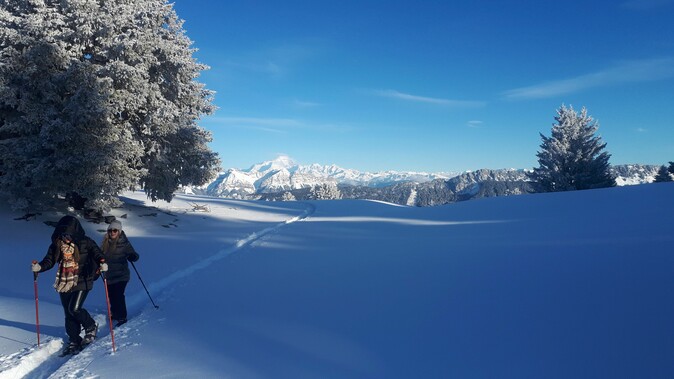
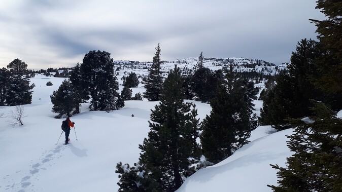
The Semnoz is the mountain of Annecy. The summit is only 25 minutes drive from Annecy. The access can be done from Annecy, Quintal or the col de Leschaux (be careful the road is sometimes closed in winter). The great "plus" of the Semnoz is the panoramic view from the summit on the northern Alps and the Jura. The "minus" is its frequentation on weekends and school vacations, periods to be avoided.
Description of the itinerary
The snowshoes are put on at the departure of the ski resort of Semnoz. Take the marked trail (yellow fluorescent markers) on the right which goes up towards the plateau. The ascent is progressive in the forest. Little by little, the view opens up and lets appear the snowy mountains of the Alps and the Jura. You arrive on the Semnoz plateau, be careful the space is shared between skiers (alpine and cross-country) pedestrians and kite skiers. Go along the cliff in the direction of the Semnoz refuge, you are facing the lake of Bourget. When you arrive at the Semnoz refuge, go up towards the crêt de l'aigle which will offer you a 360° panorama perfect for a little tea break. Then go back to the chalets of Leschaux off piste. Go to the crêt de Châtillon, the highest point of the Semnoz, before taking the track that goes down. Cross the road and take the marked snowshoe path to reach the ski resort.
2 - Aulp pass under the Tournette
Type of route: Round trip
Level: Intermediate
Elevation gain (+ and -): 490 m
Distance: 6,1 km
Duration: 2 to 3 hours
Start: Le Bois (1055 m)
Highest point: 1426 m
Road access: 35 min from Annecy town hall
Warning: Avalanche risk on the slopes of the Tournette, itinerary to be practiced when the avalanche risk is low.
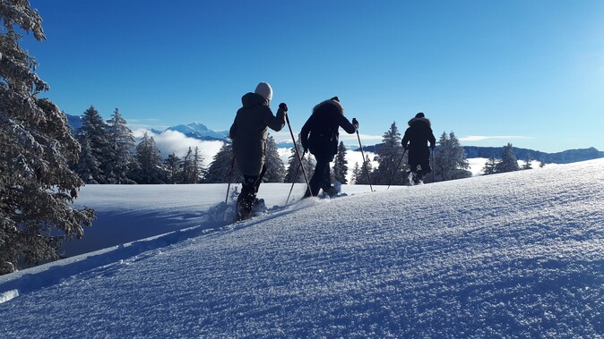
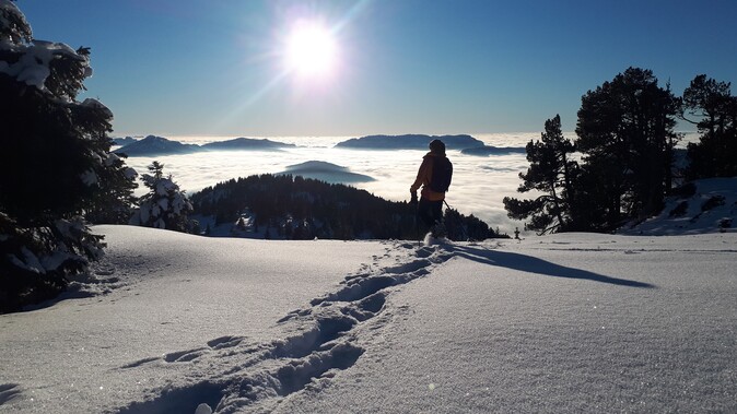
The route is located at the foot of the Tournette, the highest peak around Lake Annecy. It is a snowshoeing itinerary not very frequented in winter which will offer you beautiful views on the lake of Annecy and the surrounding massifs.
Description of the itinerary
The itinerary starts at the level of the hamlet "Le bois", the road being cut in winter for the access to the parking of the Pré Vérel. The ascent is done on the right bank of the torrent in forest. Arrived at the refuge of pré-vérel follow the rise of the summer path, the sight on the Tournette reveals itself, one feels small at the foot of these escarpments. Then join the summer trail which leads you to the chalet of Aulp. Go up to the grassy promontory from where the view opens up on the lake of Annecy, the Bauges and the Lanfonnet to the North. Go down in the coomb and then come back to the South in order to switch to the side of the preverel. Go down off the path to the refuge and then take the path up to the hamlet.
3 - Sur Cou
Type of route: Loop
Level: Intermediate
Elevation gain (+ and -): 645 m
Distance: 7,7 km
Duration: 3 to 4 hours
Start: Le Chesnet (1140 m)
Highest point: 1809 m
Road access: 40 min from Annecy town hall
The itinerary takes place at the foot of the Roche Parnal in the massif des Bornes. The orientation of the valley (North) and the location of the Roche Parnal prevent the sun from penetrating the valley in winter. The snow stays cold and is well preserved here which is perfect for snowshoeing. The summit of Sur Cou on the other hand is quickly cleared of snow in case of thaw because of its southern exposure. The arrival at the top offers a nice view on the Salève and the beginning of the Chablais.
Description of the route
From the Chesnet, follow the forest track until a junction where you turn right and cross the stream of Flan. Continue the route under the escarpment of the Sous-dîne mountain then join the chalet of Balme. This one remains open in winter for those who wish to experience a night in a refuge. Our route continues on the ridge towards the Col de Cou and then leads to the summit. For the descent we can go directly down the slope and join the hollow of the nant de cou. Then we can go north to reach the Chesnet by the trail.
4 - Le Parmelan
Type of course: Loop
Level: Advanced
Elevation gain (+ and -): 850 m
Distance: 11,1 km
Duration: 4h30 to 6h
Departure: Parking above Aviernoz
Highest point: 1832 m
Road access: 30 min from Annecy town hall
Caution: Numerous holes (lapiaz) on the plateau, itinerary to be practiced only by good snow conditions and by good weather because the plateau can quickly become a labyrinth by bad visibility.
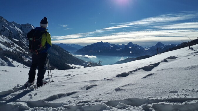
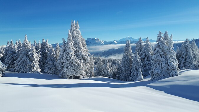
The Parmelan is a mountain which dominates the Annécien basin in the East and which culminates at 1856 m. It is a big limestone plateau made of lapiaz (rocky gruyere with many holes, faults and chasm). It is therefore important to venture there on snowshoes only when the snow cover is thick enough, otherwise you risk falling into a hole or getting lost due to poor visibility. The itinerary offers an exceptional panorama on the Aravis chain, the Mont-Blanc massif in the background, the Bauges and the Jura in the North. You can also see parts of the Annecy lake. The Parmelan refuge at the top is closed, only the "winter" part is accessible for shelter (please respect the place if you stop there).
Description of the route
In winter the access road to the chalet of Anglettaz is blocked at the level of the hairpin at the altitude of 1028 m, you can park your car there. If the snow is good, you can put on your snowshoes directly, but in general you have to wear them on the first part of the ascent. Take the summer path to reach the chalet de l'Anglettaz. When you arrive at the chalet of Anglettaz, continue the walk on the summer path, be careful from this moment you enter the plateau and the markings will be less obvious. Continue in the direction of the "petit montoir" then to the "grand montoir" and finally to the refuge of Parmelan. You will have directional signs at the small hill and the big hill to guide you as well as some yellow markings on the trees located on the course. You can go up to the head of Parmelan to enjoy the 360° panorama. For the descent, go back on your steps to the small hill which you can take to join the chalets Chappeys and then the road of Anglettaz. Go back to the parking lot via the upward path.
5 - The Glières plateau - Montagne des Auges
Type of route: Loop
Level: Intermediate
Elevation gain (+ and -): 500 m
Distance: 10 km
Duration: 3h30 to 5h
Departure: House of the plateau
Highest point: 1800 m
Road access: 45 min from Annecy town hall
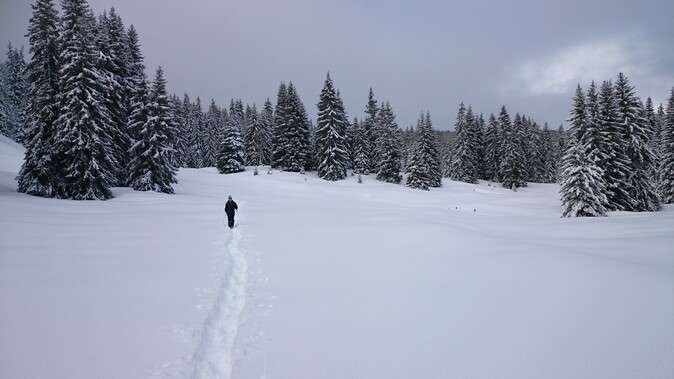
The Glières plateau is located at an altitude of 1400 m east of Annecy. Its combe configuration guarantees a conservation of snow by the "cold pit" effect. It is a departure point for many snowshoeing excursions but also for cross-country skiing. The setting is preserved because we are on a historical place of the French resistance. We propose you here a classic itinerary which offers very beautiful views on the Aravis and the Mont-Blanc.
Description of the itinerary
From the house of the plateau, take the summer path in the direction of the Chalet des Auges. You will arrive at the plan des mouilles, the highest point of the Nordic ski area. Afterwards, the ascent becomes steeper in the forest until you reach the plan du loup at 1668 m in front of the pointe de Puvat. Continue your ascent to the east towards the pas du loup and the Auges mountain from where the view opens up on the Aravis combes and the Mont-Blanc. For the return, go back on your steps and head towards the plain of Dran. Go down to the hollow where the restaurant "chez Gautard" is located. A groomed track "pedestrian" allows you to join the house of the plateau.
Discover also our snowshoe outings around Annecy with a mountain guide from the Annecy guide office:
Author : Lauris Chaumond
Photos : Lauris Chaumond